Describing the current situation
Having completed the feasibility section, and concluded that there is a feasible control strategy, Tsetse Plan then needs to obtain a more detailed picture of the local situation. In particular it needs to know about the distribution and abundance of tsetse. This will be determined by various environmental and biological characterstics of the area. Tsetse Plan has already gathered some pertinent information (e.g. the species of tsetse) but it needs to be provided with more detailed information on matters such as local vegetation, the distribution of hosts and the location of other tsetse control operations that might be in progress.
First, the programme asks you to produce a general vegetation map of the area. The map uses six, very general, categories of vegetation, and guidance on these is provided at the link bottom left.
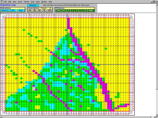
Tsetse Plan then asks whether there are areas where conditions might be adverse for tsetse. For instance, there may be areas where there are few natural or wild hosts, or people may be treating their cattle to control tsetse in a neighbouring area.
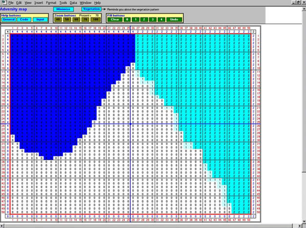
From these two maps, Tsetse Plan constructs a map of the relative abundance of tsetse in your area.
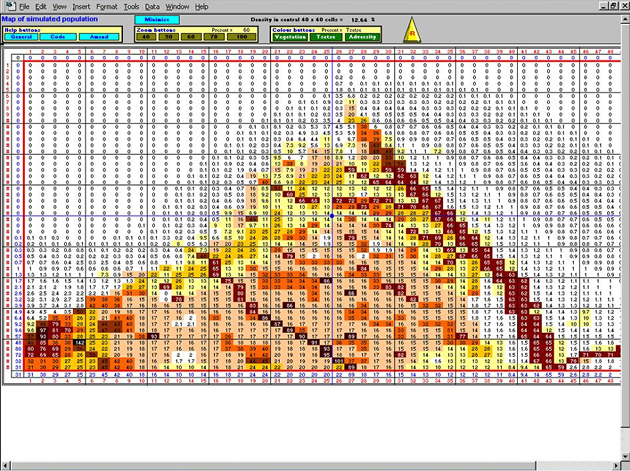
If you think the map then fits with your general expectations then the programme asks you to save the data to complete this section. The next section helps you to develop a tsetse control strategy.